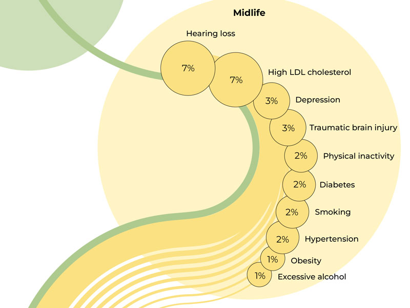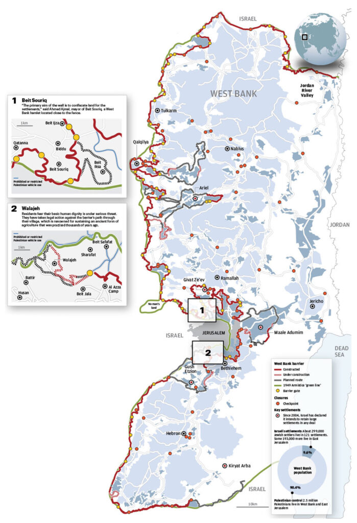
Project title
Geopolitical Map of the West Bank
Project Details
Designed a detailed map illustrating the complex geopolitical situation in the West Bank. The map includes key features such as the 1949 Armistice Line, the route of the West Bank barrier (existing and planned), Israeli settlements, closures/checkpoints, and major towns. Inset maps provide specific local details, and population statistics offer further context.